

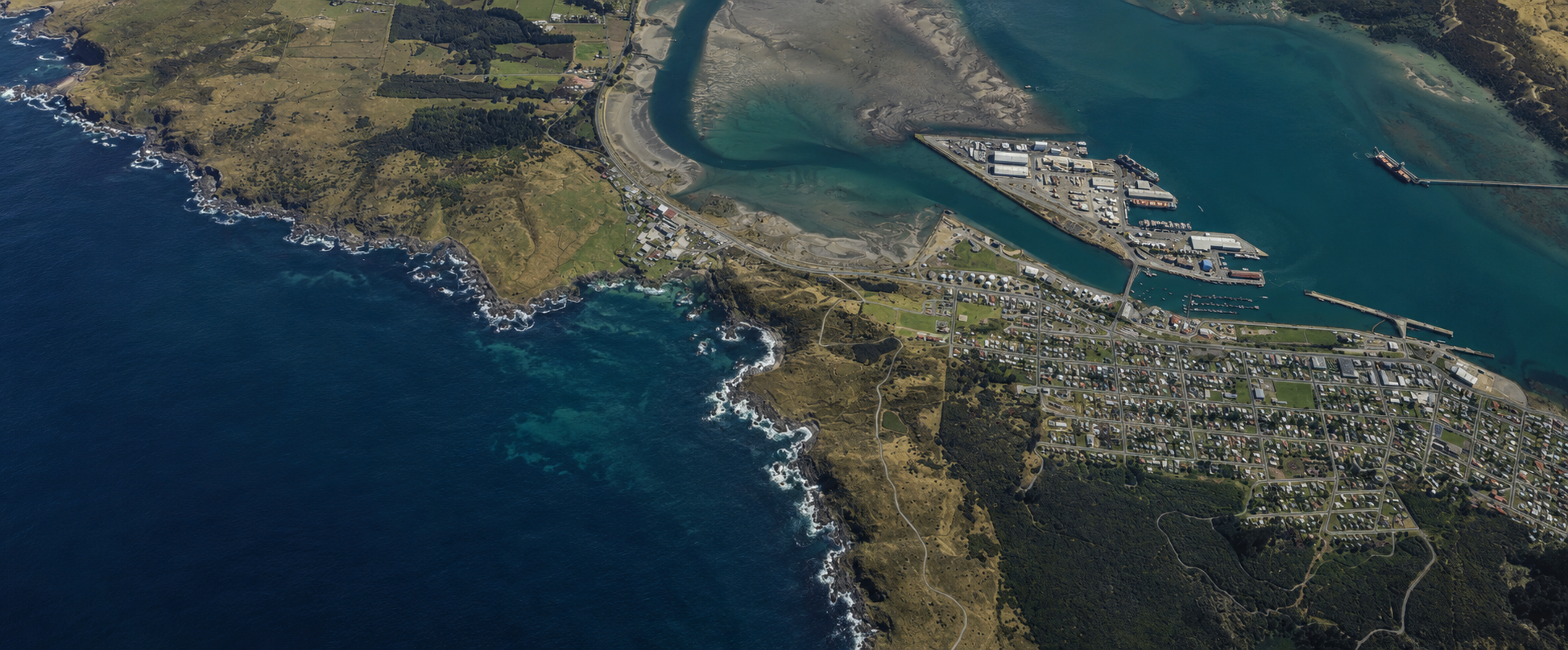
Ocean Beach Coastal Protection & Historic Landfill Removal
Read how SLWP guided DOC through complex resource consents for coastal protection works and historic landfill removal, at Ocean Beach, Bluff.
Case Study: Ocean Beach Coastal Protection and Historic Landfill Removal Works
Location: Ocean Beach Landfill, Bluff and adjacent Coastal Marine Area (CMA).
Project: Excavation of historic landfill material to enable construction of a 90 metre long, up to 15.3 metre wide rock revetment that prevents exposure of landfill waste and limits further erosion of the landfill face.
The Challenge
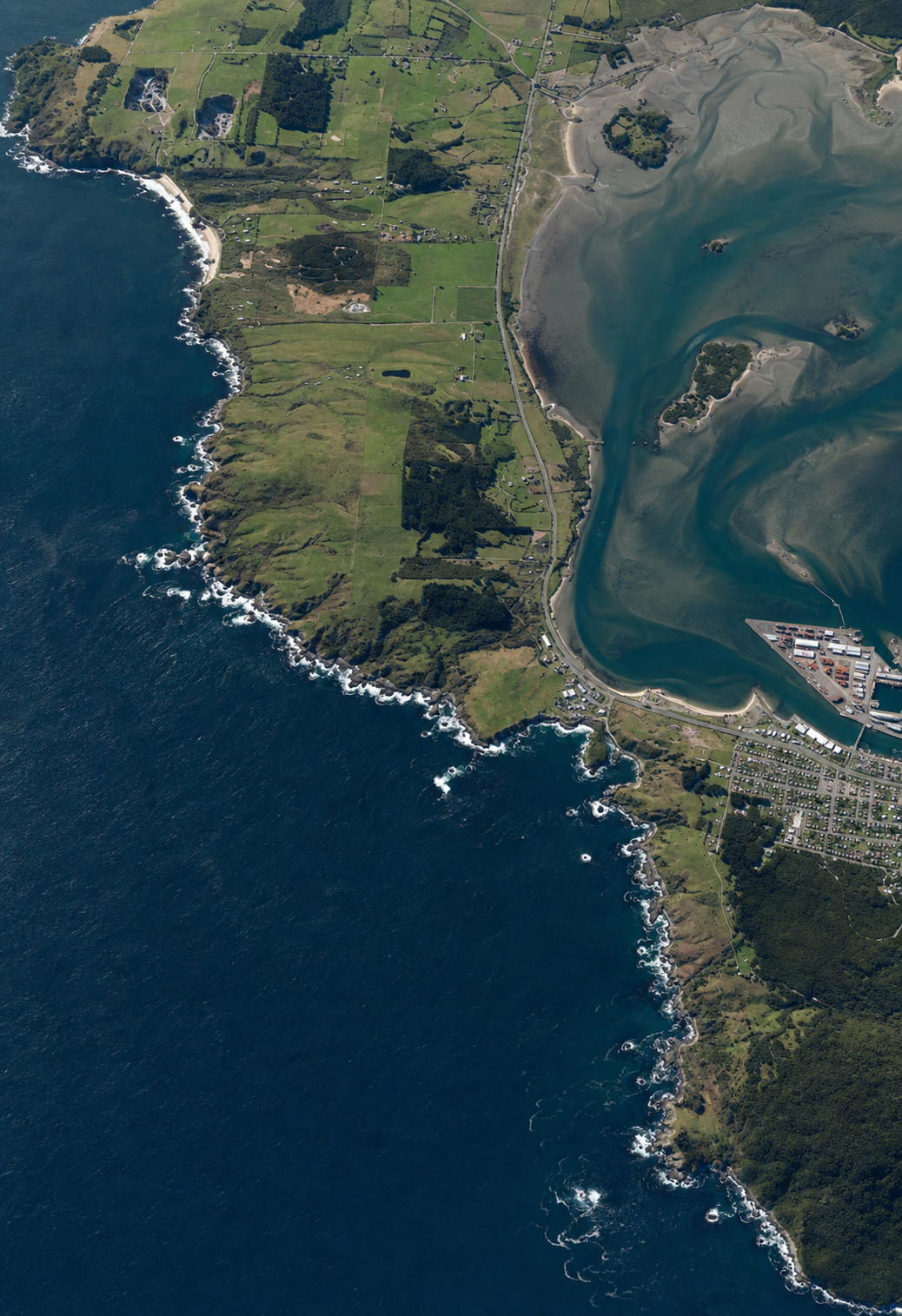
Ocean Beach Landfill is a closed landfill located on the southern coast of the Bluff peninsula. When contaminants, including asbestos, were discovered on the beach in 2018, the public was kept away from the area and around 1.2 tonnes of asbestos-contaminated material was removed by a specialist contractor. While the risk of public exposure was considered extremely low, continued coastal erosion meant there was a need to act. After extensive investigation, this involved excavating and sorting waste, and then building a 90 metre long, up to 15.3 metre wide rock revetment to manage contamination, prevent future erosion of the landfill coastal face, and restore safe public access. The work undertaken also included removing large existing concrete and other wastes from the beach.
The Department of Conservation (DOC) required resource consent (land use consent) under the Invercargill City District Plan 2019 for works above the line of mean high water springs (MHWS), and under the Resource Management (National Environment Standard for Assessing and Managing Contaminants in Soil to Protect Human Health) Regulations 2011 for the proposed volume of disturbance and the volume to be removed for disposal at an authorised class A landfill. DOC also required resource consent (a coastal permit) from Environment Southland under the Regional Coastal Plan for Southland 2013 to remove concrete and other wastes from the CMA and to occupy part of the CMA with machinery during the works.
Our Solution
Our experienced planning team stepped in to:
Identify the relevant resource consent triggers under the Regional Coastal Plan for Southland 2013 and the Invercargill City District Plan 2019, and outline activities that did not require resource consent, including through a review of rules under the proposed Southland Water and Land Plan. We worked through cross-boundary issues and regulatory interpretation questions, including confirming the correct MHWS line to apply to the proposed works. This required assessing whether the mapped MHWS (and mapped CMA boundary) or the recently surveyed MHWS should apply. We reviewed the applicable planning documents, considered the implications, and engaged early with Environment Southland and Invercargill City Council to confirm the appropriate approach.
Provide specific feedback at Working Group meetings, with further updates, planning notes, and Q&A support as needed.
Track design changes and advise on associated works, including the 4m wide temporary access track across the dune bank to enable construction machinery to access the beach and reassess the resource consent requirements to reflect the updated design and the resulting changes to consent triggers.
Assess and confirm the relevant entries on Environment Southland’s Contaminated Sites Register (Selected Land Use Sites Register) as recorded at the time, and confirm the site’s planning and statutory context, including zoning (Rural and Industrial 3 (Large) Zones), its location within the Coastal Environment and the CMA, the Statutory Acknowledgement for Rakiura/Te Ara a Kiwa (Rakiura/Foveaux Strait Coastal Marine Area), and the presence of Unformed Roads, (Outstanding) Natural Features and Landscapes, an Archaeological Site, and an Esplanade Reserve, as well as identifying the portion of the site within public conservation land (‘Conservation Area: Bluff’) and noting that Ocean Beach adjoins the boundary of the Motupōhue (Bluff Hill) Mātaitai Reserve.
Advise on the applicable provisions, including how the Environmental Reserves Omnibus Management Plan 2021 applies to the Ocean Beach Esplanade Reserve (Local Purpose), and on triggers under the Resource Management (National Environment Standard for Assessing and Managing Contaminants in Soil to Protect Human Health) Regulations 2011.
Provide planning advice on the technical information required to support the applications, including cross-checking information across the technical reports.
Prepare the viewpoints assessment submitted with the applications.
Arrange an additional pre-application meeting with Invercargill City Council, provide an early working draft of the land use consent application for their feedback, and advise Environment Southland.
Advise on affected party approvals and information requirements for applicants under the Marine and Coastal Area (Takutai Moana) Act 2011 – potential public notification was an early risk given the scale of the works, the sensitivity of the receiving environment, and cross-boundary issues.
Prepare and lodgeresource consent applications with Invercargill City Council (overall a non-complying activity, requiring a robust ‘gateway test’ assessment) and Environment Southland (overall a discretionary activity).
Secure approvals from owners/occupiers and mana whenua (including the tangata tiaki/kaitiaki for the Motupöhue (Bluff Hill) Mātaitai Reserve), notify and seek the views of Te Rūnanga o Ngāi Tahu as a customary marine title applicant group, advise the Maritime Manager/Regional Harbourmaster on the proposal, and obtain confirmation from Heritage New Zealand Pouhere Taonga that any impacts to archaeology are to be managed under Archaeological Authority.
Manage informal and formal (section 92) requests for further information, including matters arising from Invercargill City Council’s expert peer review, where contamination and effects on coastal processes were key issues, and liaise with the project team’s technical experts to provide a coordinated planning response to the section 92 request.
Review each Council’s draft conditions and provide feedback to ensure there were no conflicts and that they were workable for DOC.
Post-consent, we continued to support DOC through end-to-end advice on conditions, from pre-commencement through post-completion. This included:
Providing planning advice on the practical requirements of the conditions, with reference to both the lodged applications and Councils’ decision reports; reviewing contractor documents such as the Construction Site Management Plan for the project; reviewing technical expert documents; and liaising with Invercargill City Council’s RMA – Monitoring & Plan Effectiveness Team on potential changes, which were accepted.
Preparing condition-discharge summaries, mapping each condition requirement to the relevant supporting material, providing the planning context, and confirming that all requirements were satisfied to support efficient processing.
Providing Heritage New Zealand Pouhere Taonga with confirmation that conditions of the Archaeological Authority had been met.
The Outcome
Both applications were processed on a non-notified basis. The Coastal Permit was granted by Environment Southland in April 2025, and the Land Use Consent was granted by Invercargill City Council (by an Independent Commissioner acting under delegated authority) in May 2025.
At the Start-up Meeting, we briefed the project team (including contractors) on the conditions of each resource consent.
DOC and SLWP supported discussions with mana whenua to arrange a whakawātea (blessing) before works commenced in June 2025.
We kept stakeholders informed at key points, and offered Council and mana whenua an opportunity to visit the site before completion.
Works were completed in August 2025, with site disestablishment. A total of 9,220 tonnes of contaminated material was excavated and removed to a disposal facility.
Regarding our planning services in support of the multimillion-dollar project, Peter McGrouther, DOC’s Senior Project Manager - Contaminated Sites Programme says, “SLWP - Sonya Nicol and Burnetta Van Stipriaan were engaged to provide planning for support throughout the multistage Contamination remediation project at Ocean Beach, they provided excellent reports and consenting advice from beginning to the conclusion of the successful project, we were so lucky to have them onboard!”.
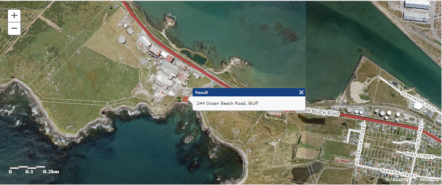
Aerial view showing the location of the site (marker at 244 Ocean Beach Road) relative to the Bluff township (Map source: Environment Southland’s Beacon mapping system).
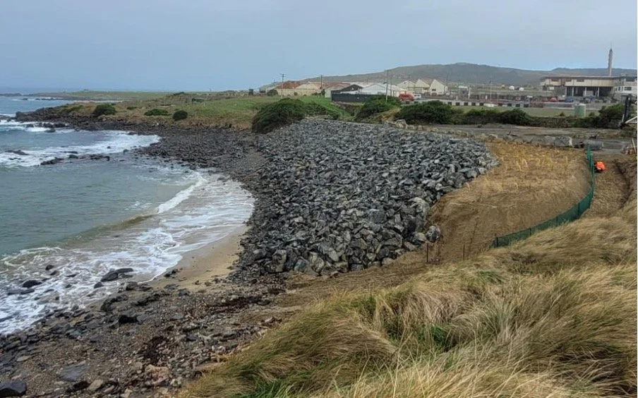
Ocean Beach rock revetment (Photo credit: Peter McGrouther).
Need Help With Your Project?
We support clients to deliver robust, defensible planning outcomes for complex and time-sensitive projects. By working with you to understand your requirements and alongside your project team, we identify potential issues early, clarify the consenting pathway and its complexity, and manage consenting requirements to reduce regulatory risk. Early planning involvement helps streamline consenting and supports smoother project delivery. Post-consent, we continue to assist by preparing well-structured condition-discharge submissions and engaging proactively with councils to keep progress on track.
Contact us today to discuss how we can support your project from first enquiry to final condition-discharge approval.